 Beach
BeachMykonos Town: Archaeological Site of Delos Guided Day Trip
1.296 reviews
Buy now
From 79,00€ per person
 Airport
 Attivita
 Village
 Citta
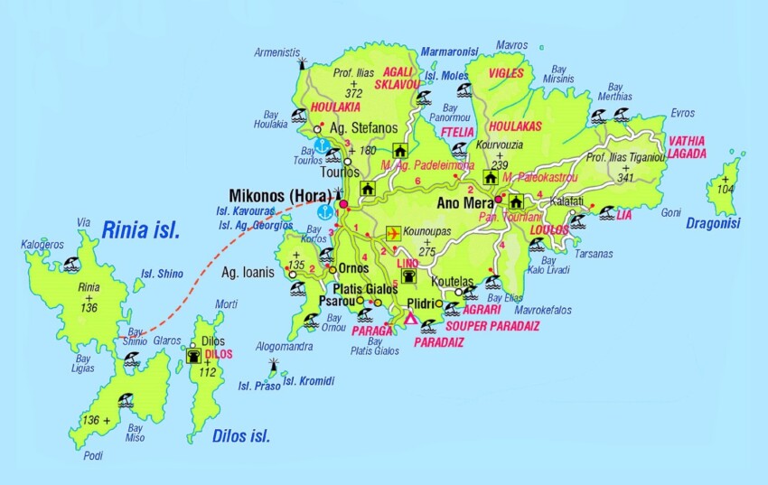
CittaIf you are planning your trip to Mykonos, on the interactive map on this page you can find all the places of interest that we recommend you visit and other useful points for your trip such as the airport. Just click on the placeholders on the map, or in the list just below, to go to the in-depth tabs on the individual point of interest.
A must-have for every tourist, the Mykonos Travel Map is very useful for planning your itinerary to discover the most beautiful beaches and must-see locations in Mykonos. Click on the thumbnail below to enlarge it and download and print it out.
Mykonos is a Greek island located in the Aegean Sea, about 10 km north-west of Santorini and 2 km south-east of Tinos. The island is famous for its natural beauty, lively nightlife and golden sandy beaches. It is an important tourist centre and one of the most popular destinations in Greece.
 Hotel
Hotel  Budget accommodations
  Apartments
  Family Hotel
  Luxury Hotel
  Resorts